
Perfect for all beginner snowshoe adventurers of any age or physical ability, it's a lovely loop with little elevation gain, weaving through the forest to a close up mountain view across the snow covered lakes.
Difficulty: easy
Round trip: 4 km
Hiking Time: 1.5-2 hrs
Elevation Gain: 30 m
FitBit: approx 6,350 steps and 10 flights of stairs
Location: Peter Lougheed Provincial Park
TRAIL HEAD
Marked: Yes
Facilities: Yes
How to get there: From Calgary drive west on HWY 1 to Canmore*. Get onto the Smith-Dorrien (HWY 742) on which you will pass the Canmore Nordic Centre. At that point you can choose to reset your odometer to 0 and your turn off will be approximately 42km from there. Your sign to turn is plenty in advance labeled as Burstall Pass. It is to the west (Chester Lake on your left, Burstall on your right). The trail begins at the west end of the parking lot.

Click for Google Maps directions


HIKE DETAILS
You can do this trip two ways as it is a nice loop. Head west out of the parking lot following the little orange snowshoe man signs. Option #1 is to go counter-clockwise and take the first right when you see the green sign that says Spray Valley Snowshoe Trails (as shown in the picture above). Option #2 is to do the loop clockwise by continuing straight and follow the orange signs that way. Either way it's straightforward route finding with your path clearly marked.
Hike the trail enjoying the forested scenery for most of the way, but find yourself quickly at the lakes. Although, with such heavy snowfall it's likely you won't actually see them! Follow the path around the perimeter of the lakes with a lovely mountain view you can't help but ooohhh and awwwee at :) Sooner than you expect you'll round the bend and see the highway and parking lot to the east and know your trip is almost at then end, but perhaps you might just have time for one more?!


Perfect snowman snow, but we can't take credit for this guy.

EXTRA TIPS
-No need to worry that there won't be enough snow in this part of the mountains! +16 degrees in the city, but still snowing on the trail!
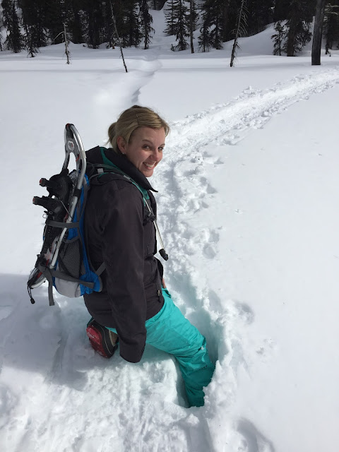
-Some may attempt this trip without snowshoes, but be very cautious of stepping off to the side of the path created before you because it's deeper than you think!
*You also have the option of driving to this trail via HWY 40. Click here for those directions on Google Maps. It's hard to say which route is better, it is really just personal preference. I find that either way your timing ultimately depends on whether you get stuck behind a slower vehicle (or train of vehicles). Though it is also worth noting that the Smith-Dorrien is gravel and HWY 40 is paved.
Snowshoe malfunction, should have packed duck tape!
Note the snow is deeper and not as solid as you think!

Happy Snowshoeing!

|
| Click for Google Maps directions |


HIKE DETAILS
Hike the trail enjoying the forested scenery for most of the way, but find yourself quickly at the lakes. Although, with such heavy snowfall it's likely you won't actually see them! Follow the path around the perimeter of the lakes with a lovely mountain view you can't help but ooohhh and awwwee at :) Sooner than you expect you'll round the bend and see the highway and parking lot to the east and know your trip is almost at then end, but perhaps you might just have time for one more?!


 |
| Perfect snowman snow, but we can't take credit for this guy. |

EXTRA TIPS
-Some may attempt this trip without snowshoes, but be very cautious of stepping off to the side of the path created before you because it's deeper than you think!
*You also have the option of driving to this trail via HWY 40. Click here for those directions on Google Maps. It's hard to say which route is better, it is really just personal preference. I find that either way your timing ultimately depends on whether you get stuck behind a slower vehicle (or train of vehicles). Though it is also worth noting that the Smith-Dorrien is gravel and HWY 40 is paved.
 |
| Snowshoe malfunction, should have packed duck tape! Note the snow is deeper and not as solid as you think! |


